9.28.2015

Hiking Yosemite’s Panorama Trail - Behind Half Dome with Generation Z

Overlooking Half Dome in Yosemite National Park, California.
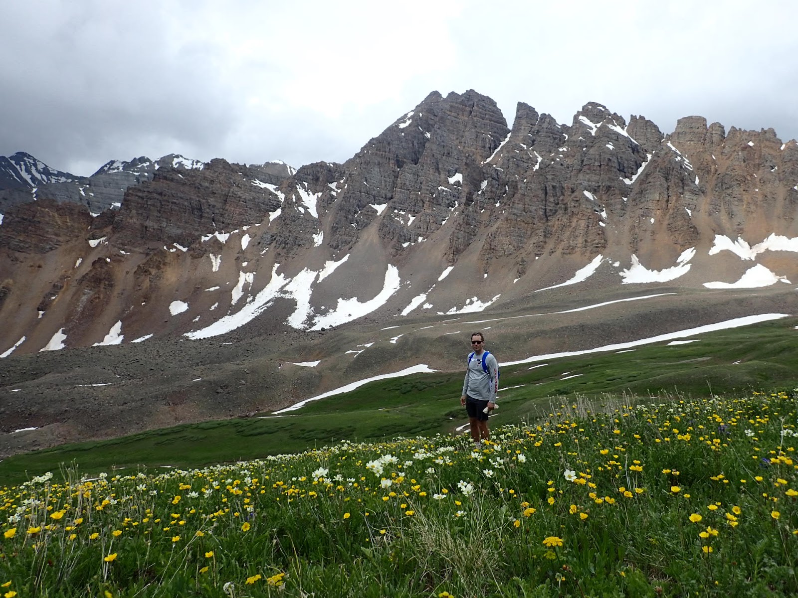
I look to my left. Half Dome rises out of the grey Sierra Wilderness and Maddie, my epic Generation Z hiking partner for the day who also happens to be my kid, scrambles up onto a mammoth rock to enjoy the view. We’re just feet from the world famous Glacier Point, a towering cliff hovering over Yosemite Valley where 3,000 feet down below, a lazy-in-August but deeply powerful Merced River carves it’s way through the landmarks.

We’ve decided to tackle the 8-plus mile sweeping Panorama Trail, which, according to the author of YosetmiteHikes is one of those hikes where “…One day you’ll look back on your life and split it into ‘before Panorama Trail’ and ‘after Panorama Trail’…” Our drop off at Glacier Point is the start of our Yosemite journey today and will take us down into the Nevada, Illilouette and Vernal waterfall depths and onto the footprints of early pioneers and a man named John Muir and his Trail.

Panorama of Half Dome, Vernal and Nevada Fall as we hike down towards Illiouette Fall, Yosemite.

Stop. Turn up your volume. Natural acoustics courtesy of Mother Nature, we hear the roar of all three falls from 7,000 feet up.


The gentle descent from the ridge leads us down towards the gorge of Illiouette Falls and Maddie and I connect without a single ubiquitous iScreen her generation was brought up mastering. We chat about wildlife, rocks, hair products, back-to-school outfits, and the future of water on the planet. 

As a “Generation Z-er”, the use of technology for her is a tool or appendage that she was born with. The use of an iScreen for her is just about as comfortable as the use of an arm or a leg. However, also as a “Gen-Zer”, valuing the importance of caring for the stunning wilderness we are treking through is a deep part of how her generation is also defined. According to a recent article in the New York Times, she and her generation are mindful of the imprints their footsteps will make on the planet. Although they are seeped in technology, they aren't driven by it and they are “...conscientious, hard-working, somewhat anxious and mindful of the future." And that, honestly, makes me happy and relieved and eager to continue to share my passion for the outdoors and nature with her. There is hope!

Pools of water above Illiouette Fall in Yosemite National Park on the Panorama Trail.
At Illiouette Fall, the low California water table leaves us gorgeous, hot rocks above the falls to lay on for a snack break. Pools to dip in our feet are irresistible and we make plans to come back here someday soon with a huge picnic and wouldn’t the other kids love this.

We begin the climb out of the valley towards the back of Half Dome and the base of Nevada Fall via a seemingly eternal series of switchbacks on a hot day. Trail magic happens when you connect over switchbacks, and passing back and forth leftover Hershey bars from s’more fixings as we trek along, up-up, makes our bonding via chocolate and hard, switchback-breathing more true.

Back side of Half Dome, Yosemite National Park.
There now before us is the glowing monolith of the backside of Half Dome. We’re so close now I can almost feel the weathered cracks on it’s exposed dome and I find myself on a high that has nothing to do with the chocolate. This is why we preserve wilderness. This is the gift I want to leave my Maddie and her generation of Zs. And this is why I’m so thrilled to know that these kids feel the exact same way. They just have more brilliant tools to manage it.

Celebratory stop at Nevada Falls, Yosemite. 


Coming back down, both in my head and on the trail, we bump into the renown Mist Trail and lead ourselves over to Nevada Fall. In the shadow of the massive Liberty Cap, the falls are a wild combination of raw hydro-power and interesting people watching. Maddie is awed by the group of likely-Europeans sunning themselves in tighty-whitey bathing-suit type gear on the rocks above the falls.

After having hiked mostly alone for most of the morning, it’s impossible not to notice we’ve now hit one of the most popular hikes in the park. The crowded trails are worth it as the views continue to overwhelm the “awe” senses for Maddie and me as we begin the 2,000 foot descent and end of the Panorama Trail via the John Muir Trail.

Half Dome, Liberty Cap and Nevada Fall as we descend on the John Muir Trail, Yosemite.
No pain no gain. Screaming feet, toes crushed to the front of our boots in the last mile make us laugh with tears in our eyes and break out into a jog and I’m having a blast going through this with a young gal who finds me mostly embarrassing at home these days. I may be embarrassing, but I am deeply honored to have my 10 year old respect the restraint, humility and incredible benefits that preserving this wilderness can bring to an individual and to the crowds around us.

That sort of speech may make her roll her eyes. “Embarrassing Mommmmmm.” But inside, I know she’s feeling the essence of that truth. Embarrassing or not.

90 degree heat we are HOT & covered in dirt at the end of the hike. Merced River. Yosemite Valley.
Our final steps to the bottom of the valley towards Happy Isles and the last grunt to our awaiting pick-up at Curry Village are a mix of tiredness, dirt, and giddiness. Maddie is a true adventure partner. She kicks it on the trail and she’s part of a generation who will actively engage in taking care of the land we were blessed to pass through today. 

As I look at the Merced River’s winding path below the grandeur of the granite walls we’ve just hiked down, I see a bright, panorama of our future.

For more conversation and photos find me on Instagram, facebook, and twitter.


-Outdoorsy Mama  

Trip Report:
Location: Panorama Trail. Access via Glacier Point (descending) or Happy Isles (ascending). Yosemite National Park.
Length: between 8-9 miles
Level of Difficulty: Strenuous
Elevations: @ 3,200 feet
Exposure: Mostly sun.
Kid Friendly? For experienced kid-hikers. Exposures around waterfalls are extreme and deadly. Know your kids. 
What to Wear/Bring: Layers. Sun protection. Water & filter. 
Tip: Low to no cell service. Be prepared.

Where to Eat: After the hike head straight to the closest source of food at the base of the trail in Yosemite Valley - Curry Village's Pizza Deck. Outdoor seating with a festive outdoor crowd & all the right food to cure the salty, sweet, crunchy cravings we've been having all day. Pizza Deck in Curry Village 

For More Yosemite Articles:

9.23.2015

Fall Gear Layering Guide - 4 "Must Have" Top Layers for Hiking for Adults and Kids

Insulating Layer at Sea Ranch on the coast of Northern California.

It’s time for cooler days and crisp nights. Apple cider smells tease our taste buds and cascading, colorful leaves make irresistible piles for our footsteps to crunch through. 

Ah, yes, Autumn is in the air and fall hiking is always a favorite. 

Big temperature swings within a fall day means layering is key. Here are the basics for our tops for what we all need to have in our packs ready to pull on, pull off, and repeat. This will keep our body temperatures comfortable so we don’t get either the shivers or, worse, bake & broil and thus become pains in the snizzles for everyone else on the trail.

It’s all about layers, layers, layers.

Base Layer performance shirt by Icebreaker in Zion National Park, Utah.
1 – Lightweight or Base Layer: “The All Rounder”
This is one of my most vital layering pieces. In the fall yes, but also year round. This is the layer that can be worn on a hot day to keep the sun off of us. And it can be an important part of building warmth on cooler or cold days. I basically live in this layer all year long. My favorite material is polyester or the relatively newer variation of merino wool. This is not your grandma’s scratchy wool sweater wool. These natural merino fibers straight from the bodies of New Zealand sheep can actually keep us cooler on hot days and warmer on cold days. A win win. This piece is a must have as a layering essential. Look for @ 150-200gm weight.


Mid Layer by WoolX on Muir Beach Overlook in Golden Gate National Recreation Area, California. Aspen the dog.
2 – Mid Layer: “The Quick Warmer-Upper”
The mid layer is just that much thicker than your base layer. Lots of these come in ¼ zip from chin to chest and are like a lightweight sweater for when the first chill comes on. Great to wear hiking up the mountain on a cool day allowing our bodies to breathe and still feel warm. Again, more and more I’m a sucker for the Merino Wool version of this layer. The fiber material is natural so there’s no yuk plastic smell when it first arrives in packaging. And the natural fibers don’t trap our body odor as much so there’s much less body stink. A HUGE bonus on a sweaty day. Your hiking neighbors will thank you. Also comes in polyester fabric. Look for @ 250gm weight.


Two types of Insulating Layers at our campsite in Mt Tamalpais State Park, California.

3 – Insulating Layer: “The Sleeping Bag for Your Torso”
Now we’re talking about a jacket. Usually a full zip. This is the sleeping bag for your torso. There are high-performance fleece fabric jackets, though my favorite are the cozy down or “synthetic down” jackets. Many brands have a special synthetic material similar to down that isn’t as puffy as the old, giant, goose puffers. This material is convenient because it stays warm when wet from weather or sweat and the jacket fits more easily and sleekly underneath layering pieces. Think cozy. Reminder that natural down gets cold when wet and can get too hot during active sports.

Outerwear Layers at the summit of Killington Peak, Vermont.
4 – Outerwear Layer: “The Weather Beater”
This final layer determines whether you get to continue your epic hike when the rain storm or snow storm or wind storm rolls in, or whether you lose it and start bawling in misery on the trail miles from home ‘cause you’re wet to the bone and frozen. One word we should always look out for with this layering piece is the word “breathable” for outdoor activity. The old yellow slickers that gnarly fishermen still wear on the high-seas should probably be left on the boat, as a more flexible, breathable, water-resistant or water-proof jacket is more practical for the trails. And, final note, always make sure that the size is large enough so that the other layers can fit underneath it as well.

These four layers work for adults and kids. I carry a variation of all of these in my backpack basically all of the time, and definitely during colder and less predictable weather months. An example of fall unpredictability? Hiking in Boulder, Colorado in early November. Last year on on a hike it was 70 degrees when we hiked the Flatirons one day. The next day there was 40 degree temperature drop and we hiked in a massive, pelting snow storm. 

So much fun! Go figure. Remember, you're only as happy as you are prepared with the right gear. Fall hiking.

-Outdoorsy Mama

Disclaimer: All opinions are my own. Hike and adventure with care. Icebreaker and Woolx products were sent for product testing and review. Get dirty.

For More Information on Layers:

9.01.2015

Colorado's Highest Named Pass: Electric Pass During Thunderstorm Season. Colorado Hiking.

Electric Pass Peak. 13,635' Maroon Bells Snowmass Wilderness. White River National Forest. Colorado

My brother and I shake off our grubby trail runners as we get ready to head up the renown Electric Pass near Aspen on this early, July morning. As we both are well aware when hiking in Colorado during the summer season, we need to hightail it up to the summit before the day wakes up and the notorious afternoon thunderstorms come wreak havoc with all of us hikers in the Rockies.

A zappy, excited current zings through the adventurous cells in my body as I glance at the pass on the trail map that is described by guidebooks as “treacherous” and “not maintained.” Electric Pass is the highest named pass in the notoriously high state of Colorado, a state where fifty-three 14,000-plus foot mountains are constantly on epic summiting parade by thousands of outdoor adventure seekers.

High alpine meadow and Pika habitat heading up to the pass. 

At around 13,500 feet, Electric Pass’ trail on the western Conundrum Valley side has been abandoned by humans. Nature has been invited to take the trail back due to unpredictable and dangerous rocky slopes that wreak havoc with human limbs and lives. We’re coming up from the other side, the Castle Creek side, which is a 9-plus mile round-trip, 3,700-plus foot elevation gain hike with a well maintained trail and passes the stunning and popular Cathedral Lake on route.

Electric Pass was given it's obvious and ominous name by an unlucky ranger in the 1920s who was knocked to the ground at the summit three times in a row by static electricity. He apparently literally rolled down the mountain to safety. Heeding that warning and not wanting to fool with mother nature and her proclivity to throw bolts after noon on Colorado summer days, my brother and I are awake with the birds and at the trailhead around sunrise, knowing we want to be off the summit by 11am to be safe.


Jaw dropping wildflowers. Cathedral Lake in the distance.

2.5 miles up and just one other friendly dude named Ben on the trail, we split at the Cathedral Lake turn-off and head up into the bowl of heavenly wildflower show extraordinaire as the route follows the scree and pinnacles of Cathedral spires towering to the west. We’ve hit the Vegas Jackpot with Colorado wildflower season this year as we are literally thrown into a Sound-of-Music-wildflowers-on-steroids-and-Miracle-Grow moment. An enormous giant swatch of a lush, green high-alpine meadow is completely filled with a popping, bursting kaleidoscope of flowers.

Keeping an eye on the clouds and an ear for any signs of rumbling, my brother and I know we’re still good and we stop for a snack on the Leahy Peak saddle just below the electric peak to munch on our hikers’ sandwiches – peanut butter paired with whatever we could find in the cabinet the night before.

Leahy Peak Saddle pic of me and my brother. Photo by Ben the only other human around.

Statistically Colorado is the state with the third most lightening related deaths in the country and social media is teeming with stories of near strikes and, unfortunately, people getting hit. This includes the more recent tragic story of a newlywed couple on Mt. Yale in July with the bride passing away from a fatal lightening strike. According to local meteorologists, this summer in Colorado has been more active than usual due to unsettled spring and summer skies.

Keeping these stories and thunderstorm avoidance top in our mind, we brush off the sandwich crumbs and start the scramble to the peak. We’re off official pass trail now and are making our way up jaggedy rocks, skirting to the side of the ridge-line which is still partially covered in snow in mid July. We climb higher and arrive at the unadorned Electric Pass Peak and find a rock to perch on that overlooks the massive expanse of Colorado wilderness and possibly allows us to see into other worlds and distant planets. Just wow.


Forging our own trail to Electric Pass Peak.

We are nose to nose with the famous Maroon Bells and Pyramid Peak. The massive 14ers and 13ers including Cathedral Peak, Castle Peak, and Hayden Mountain are still topped with snow and surround us. We’re in a 360 degree circle of frosted, stunning Rocky Mountains. 


Electric Pass Peak. 13,635' Maroon Bells Snowmass Wilderness. White River National Forest. Colorado
Although there are clouds in the sky, they are peaceful. We have no hair standing up on end today and no need to do barrel rolls down the mountain to safety a la unfortunate 1920s ranger. 

We take a moment to soak it all in and enjoy our Rocky Mountain high. At the top of Electric Pass safely and smartly, charged with the exertion and visual reward that came every step of the way. Life is good. Hike on.

-Annie for Outdoorsy Mama

Trip Report:
Location: Electric Pass Hike, part of Cathedral Lake Trail, Maroon Bells Snowmass Wilderness, White River National Forest, Aspen, Colorado
Length & Elevation Gain: @ 9 miles, @ 3,700 feet *approximations.
Elevations: Electric Pass Trail: @ 13,500 feet. Electric Pass Peak: 13,635 feet. *approx
Level of Difficulty: Difficult to strenuous.
Exposure: Mostly sun. Steep trail and switchbacks.
Kid friendly? The trail to Cathedral Lake and the saddle before the pass is relatively kid friendly for experienced hiking kids. The final scramble to the “peak” of Electric Pass is sketchy with steeps and jagged rocks and boulders. For experienced teens and up. Use your judgment. Know your kids.
Best Time to Go: Before noon during hiking season. NEVER when there is thunder or lightning in the air.
Reward: Stunning views of multiple 14ers in the Maroon Bells Snowmass Wilderness and Cathedral Lake.

What to Do - Lightening Tips for Hikers:
Prevention -
Check the weather the night before and before you leave.
Hike EARLY.
Plan on getting off the summit between 11am-noon.
If you see thunderhead build up, hike another day.
On the hike -
Any sound of thunder, start down immediately.
Don’t stand under a solitary tree.
Find the lowest point of open area.
Get away from water.
Adopt the lightning position.
*there are a thousand tips, these are some basics, be sure to do your homework

Where to Eat:
Pine Creek Cookhouse - After the hike, head over for a celebratory local, craft beer and lunch at the Pine Creek Cookhouse. It’s just a few minutes drive from the trailhead and serves interesting tastes like Colorado Elk Bratwurst. A+ views. Tip: Cell phones do NOT work in this valley. www.pinecreekcookhouse.com